ISRO puts EOS-05, India's first geo-orbit imager, into sub-GTO on GSLV-F17
The 2,367-kg satellite left Sriharikota at 2:55 a.m. on 4 September and reached a 171 by 31,026 km orbit about 18 minutes later. Chairman V. Narayanan called it the heaviest payload a GSLV has flown.

Sriharikota2 min read
Last updated
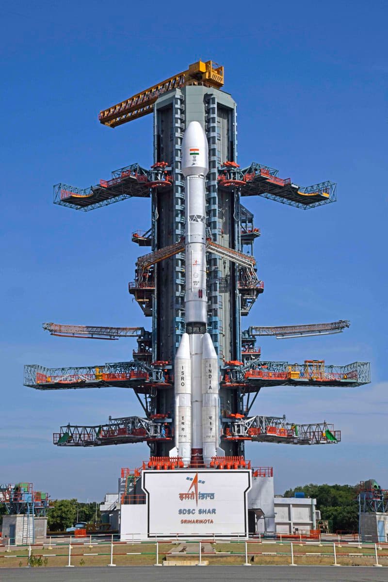
At 2:55 a.m. on 4 September, in rain at the Satish Dhawan Space Centre, a 51.7-metre GSLV-F17 left the second launch pad with EOS-05 on board. About 18 minutes later the 2,367-kilogram satellite was in its planned sub-geosynchronous transfer orbit.
ISRO chairman V. Narayanan said the vehicle "successfully and precisely injected" the spacecraft. He gave the injection orbit as 171 kilometres by 31,026 kilometres, with an inclination of 19.28 degrees, and said the apogee came out about 1,000 kilometres higher than the plan. That extra height, he said, would let the satellite see a larger area once it is raised to its working slot. He also said EOS-05 is the heaviest satellite a GSLV-class rocket has carried.
The countdown ran 27.5 hours from Wednesday night. Liftoff mass of the three-stage vehicle was 420.5 tonnes. The first stage is a solid core with four liquid strap-ons. The second stage is liquid. The third is the CUS15 cryogenic upper stage, burning liquid hydrogen and liquid oxygen. This was the 19th flight of the GSLV and ISRO's first successful orbital launch of 2026 after earlier setbacks this year.
Why geo-orbit imaging is a different machine
Most of India's working Earth-observation satellites fly in low Earth orbit or in sun-synchronous polar paths. They pass over a given district on a schedule of days. EOS-05 is built to sit near 36,000 kilometres, matching Earth's rotation, so it can stare at the same landmass for long stretches.
From that height the satellite is meant to return repeated images of the Indian landmass in visible, infrared, multi-spectral and hyperspectral bands. Public briefings around the flight put the revisit for selected regions at minutes rather than days, and a full-country pass on a half-hour cycle once the spacecraft is on station. The stated uses are cyclone tracking, flood and fire watch, agriculture, and what Narayanan called "strategic data".
Onboard thrusters will now raise the orbit in stages. Until those burns finish, the satellite is a transfer-orbit object, not a finished geo-imager.
The flight this one replaces
EOS-05 is the follow-on to EOS-03, flown on GSLV-F10 in August 2021. That mission ended at 307 seconds when an onboard computer aborted after the cryogenic upper stage failed to do its job. A post-flight review pointed to an anomaly in that stage. Friday's injection, on an indigenous cryogenic stage, is the first time India has placed a dedicated imaging satellite onto a geo-transfer path.
Prime Minister Narendra Modi posted that the flight was "India's first-ever imaging satellite from geosynchronous orbit" and a mark of the space programme's range. The political line is familiar. The engineering point is narrower: a 2.3-tonne camera bus on a GSLV, after a failed predecessor, now has to complete circularisation and prove that a geo-staring imager can feed disaster rooms faster than a LEO constellation that only visits.
ISRO has not published a public date for first light. The next facts that matter are the orbit-raising burns, the health of the imager after the long coast, and whether the extra 1,000 kilometres of apogee shortens or lengthens the time to station. Until those numbers appear, the achievement on the ground is the injection itself: a wet pad, an on-time countdown, and a cryogenic stage that held.
Continue reading
 Politics
Maharashtra leads September GST at 29,986 crore as Manipur posts a 145 percent rise
Almanaque Digital DeskMumbai
- News
Machchhar tells Modi he opened the FZ1073 door while the blows were still landing
Almanaque Digital DeskNew Delhi
- News
Seven devotees die on the Samruddhi Mahamarg near Dhamangaon
Almanaque Digital Desk